Brief History of Rodanthe, Waves, and Salvo
This area of Rodanthe, Waves and Salvo were originally three distinct early settlements once referred to simply as the Chicamacomico Banks. Believe it or not, this area was heavily wooded and these three small settlements were separated by creeks and bridges only. However, even though these settlements were friendly and tight knit, their separation in topography and varied interests caused them to grow individually.
As of 1850 the census reported the area with 37 families with a total of only 205 people living in the area. The villages of Rodanthe and Waves were the more closely knit of the trio. The original name for Rodanthe was actually North Chicamacomico and then Waves was simply called South Chicamacomico. At that time Salvo was originally referred to as Clarks or sometimes Clarksville. Although the three villages were closely located geographically, Clarks functioned more independently then its two northern neighbors.
As might be expected, the Chicamacomico Banks had many historical ties to the Manteo and Wanchese areas. Also, despite the reputation of being people from a very isolated area, the locals from the area were actually well traveled because of the area's close connections with the US Coast Guard and family relocations all up and down the east coast. For a few decades of the mid-twentieth century, Rodanthe was the northernmost stop of the Manteo-Hatteras Bus Line which used sand roads. This bus line helped familiarize the southern Hatteras Island villagers with their northern neighbors.
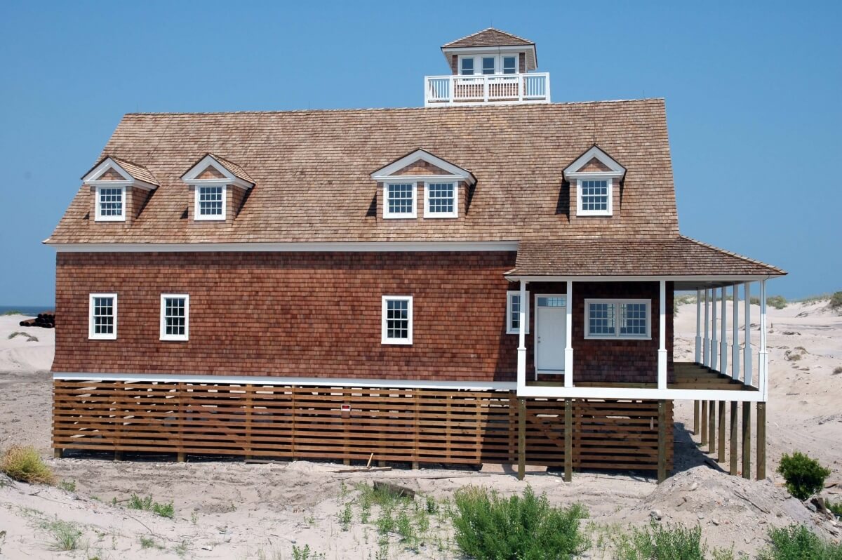
Rodanthe also had the distinction of having the area's only man made refuge for boats in the region. In 1936 the US Coast Guard built a channel and T-shaped harbor which was named the Blackmar Gut. They used the location for the US Chicamacomico Coast Guard Station. Today, nearly all remnants of the earlier villages have all but disappeared along with much of the original natural landscape. Visitors will be interested that there was once a natural wetland area called Aunt Phoebe's Marsh located in the current area now covered with an abandoned theme park, waterslide, go-cart tracks and campgrounds.
Rodanthe
In 1874 the US Post Office refused to use many of those long Indian names that were common for Outer Banks villages. No one is sure why North Rodanthe was chosen but it is theorized that it is named after a non-native flower Rodantha. Some of the other names that Rodanthe has gone by in the earlier years have been Big Kinnakeet, Chichinock-Cominock, Chicky, Midgett Town, Northern Woods and even Northard Woods.
Waves
First named South Chicamacomico and then South Rodanthe, villagers accepted the name (Waves P.O.) which was proposed by local postmaster Anna Midgette with an eye toward tourism in 1939. Villagers wanted to keep P.O. in the name to show their strong reluctance of changing the name and giving up the original Chicamacomico designation. Soundside mariners often referred to Waves simply as (the hump in the middle) referring to the fact that when sitting in a boat in the Pamlico Sound and looking east Waves appeared as a hump.
Salvo
Salvo was originally named Clarks or Clarksville. It eventually received its official village name very strangely indeed. A Union ship commander passing the Island asked his navigation officer what was the name of the village that he was seeing as they passed close by. While looking at his nautical charts, the crewman said that he could not see any name listed. The commander ordered, "OK, give it a salvo anyway." (salvo = a simultaneous cannon firing). The crewman then logged the word "salvo" on the chart with an arrow towards the area. Future charts were written with the word Salvo and that name actually stuck as the official Union name for the area and was designated by the US Postal Service.

Old Salvo Post Office
The Salvo Post Office was constructed in 1910 and was recognized by the Postal Service as the second smallest post office ever. It was destroyed by a fire in 1992 and then restored shortly after. It reflects a unique tradition of a portable building being purchased by succeeding postmasters and moved to their respective properties. Stop by and take a picture of this building and get a feel for traditional island life in the earlier days.
Oregon Inlet Life Saving Station
Originally known as the Bodie Island station the life-saving station at Oregon Inlet was completed in February 1898 it was the third station following earlier ones built in 1874 and 1888. It underwent significant modifications in 1933-34 and was abandoned in 1988 and was replaced by a new station in 1990. After the Coast Guard left, the site was given to Dare County, which faced legal battles over the land. In 2000, it was transferred to the state and assigned to North Carolina Aquariums. It is listed on the National Register of Historic Places and is visible from the Herbert C. Bonner Bridge.
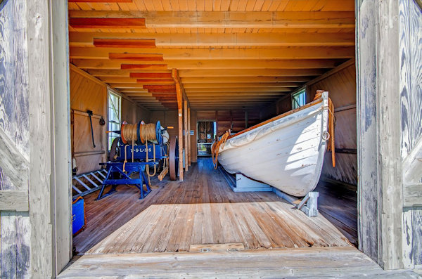
Chicamacomico Life-saving Station
Established in 1874, it was home of the state’s first trained first shore-based rescue site, featuring original buildings and historic rescue equipment. Recognized rescues include the 1918 "Mirlo" rescue, where 42 sailors were saved from a torpedoed tanker by Keeper John Allen Midgett and his crew. Rasmus Midgett, another notable surfman, single-handedly rescued ten victims from the barkentine "Priscilla" in 1899. The site showcases artifacts, including surfboat No. 1046 from the Mirlo rescue and personal items from the Midgett family.